Planning & quantities
Use existing conditions, building components and outdoor areas as a basis for refurbishment planning, design coordination, and cost and quantity estimates.

BUILDING DIGITALISATION
We capture your property as a point cloud and turn the existing building into a usable BIM model. A practical data foundation for renovation, planning and operation.
01 / ONE DATASET FOR YOUR PROPERTY
From individual components to a property portfolio, geometry, product information and evidence belong together.
Our Scan-to-PLM service brings surveys, BIM modelling and product data together in a structured building context.
This creates a foundation for renovation, transactions and reporting that can be maintained throughout the building’s use.
PROJECT IN PRACTICE
80,000 m² of surveyed area, indoors and outdoors: RGB imagery, thermography and 3D laser scanning were used to digitise the VfB Lübeck site.
BIM model, 3D/2D construction plans, virtual 3D tour, 3D print and ESG reports.
Discuss a similar project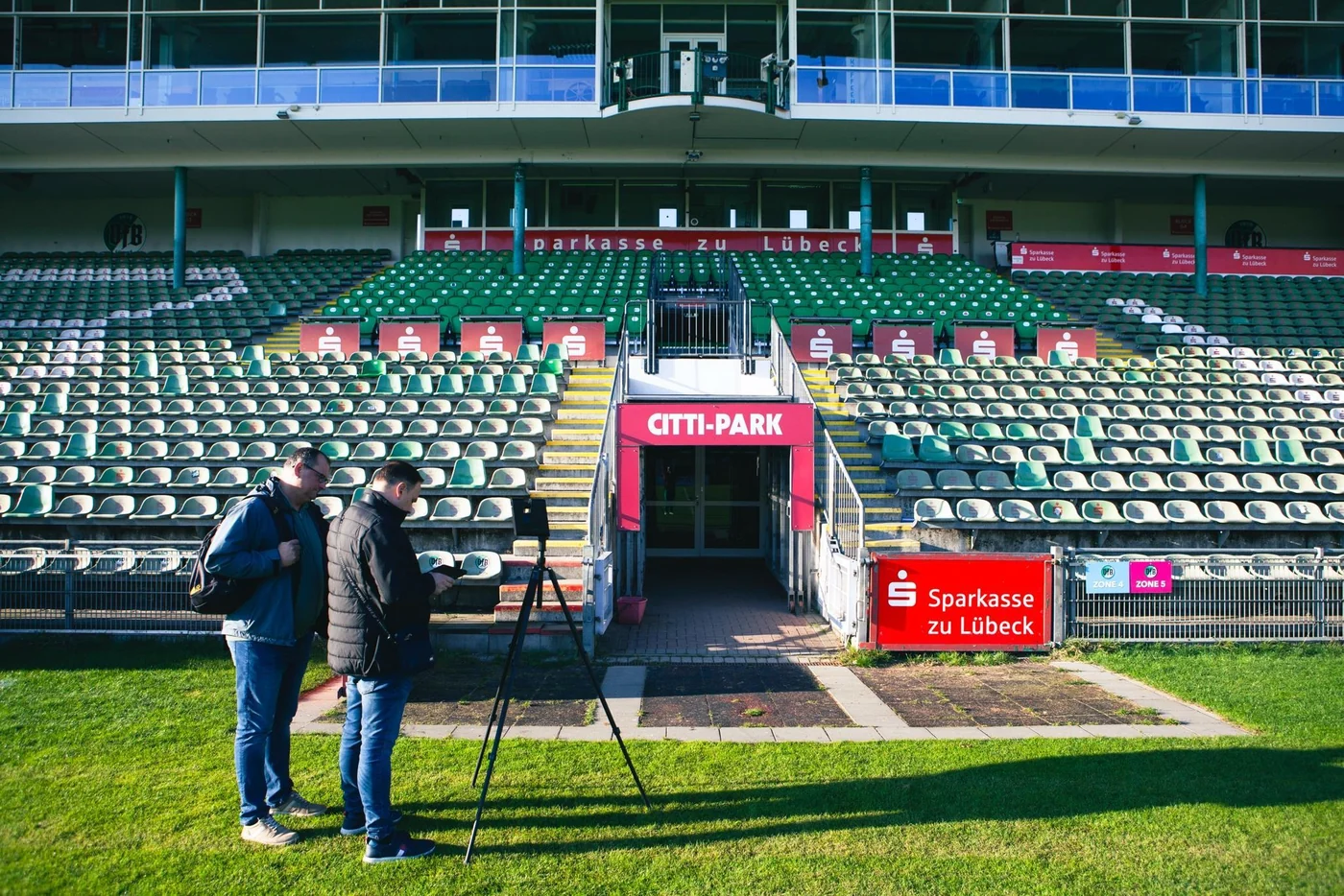
FROM SURVEY TO APPLICATION
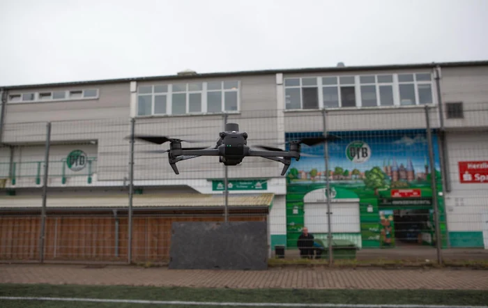
The project film follows the stadium survey through the virtual tour to the BIM model. The model views show how the data can support planning, coordination and building operations.
Starts as you scroll · pause at any time.
The film shows the stadium and drone survey, a digital tour of outdoor and indoor spaces, and the BIM model of the stand with views into its rooms.
Open the project film directly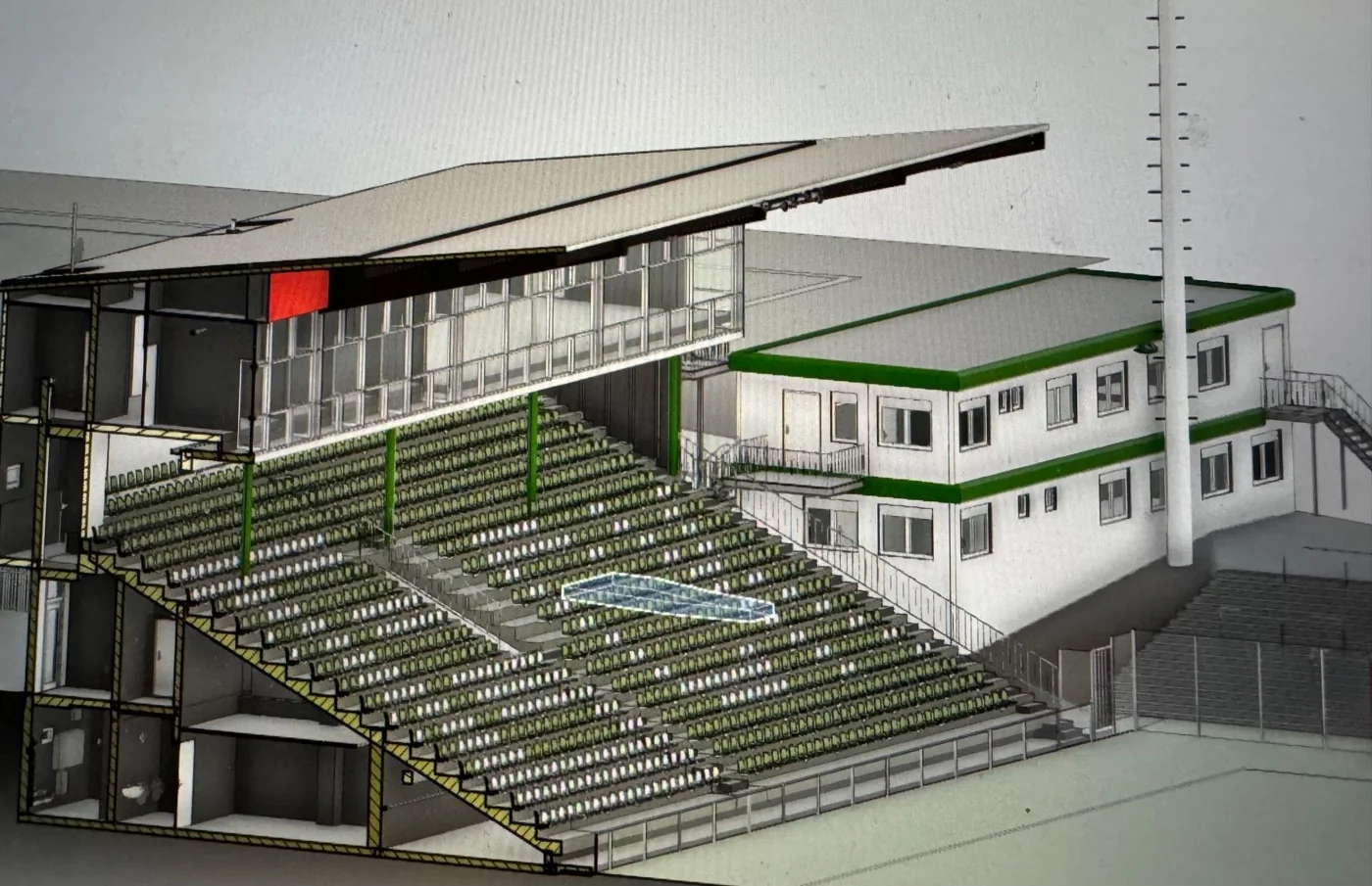
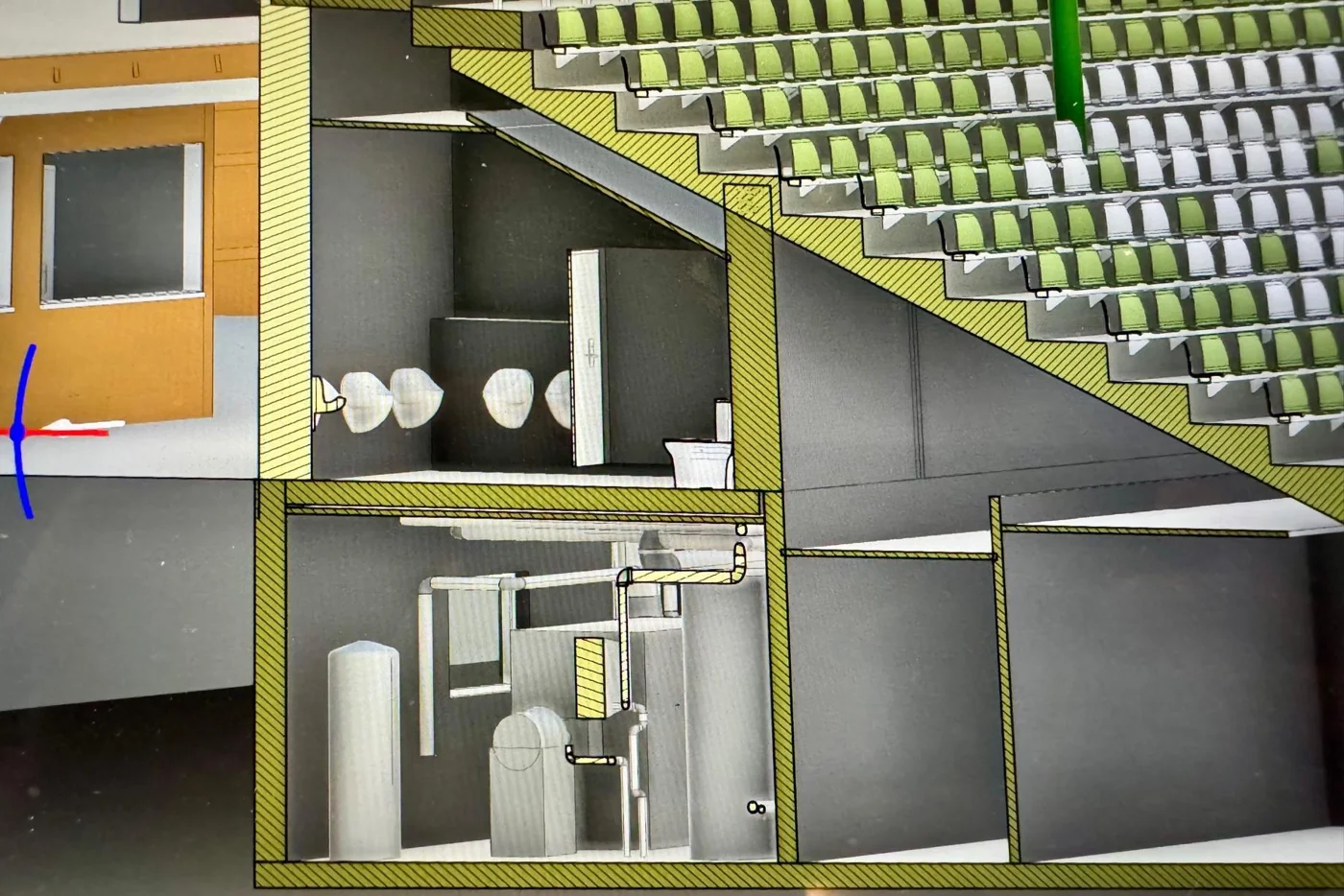
Use existing conditions, building components and outdoor areas as a basis for refurbishment planning, design coordination, and cost and quantity estimates.
Bring building components and service routes together in the model. Review spatial conflicts during planning and discuss them with the trades involved.
Locate rooms and components in the digital model as a basis for facility management, maintenance planning and sharing knowledge of the existing building.
Show sponsors’ and VIP areas virtually. Spatial views support presentations of hospitality suites and advertising spaces to prospective partners.
02 / SERVICES
Select a step to explore how building data is captured, connected and maintained across the lifecycle.
STEP 01
LiDAR and drones capture the property indoors, outdoors and from the air. The point cloud documents the geometry of the existing building.
STEP 02
The point cloud becomes a structured BIM model. AI supports component recognition, while assignments are checked and shared through IFC.
STEP 03
The component inventory is structured and linked to relevant digital product passports. Product types, batches and individual instances remain distinct.
STEP 04
The planned GS1 building passport brings together the identity of the property and its components with the data to be released.
STEP 05
Operation, maintenance and evidence are maintained in the building context. Changes such as repairs or replacement should remain traceable throughout its use.
Building surveys with LiDAR and drones, point clouds and Scan-to-BIM. We agree the scope, data formats and level of detail for your project.
The building and product passport ecosystem will connect components, manufacturer data and evidence. GS1 integration, registration and external interfaces are agreed for each project.
03 / DIGITAL BUILDING PASSPORT
A window, a ventilation unit or a façade: every installed product has its place in the building’s digital context.
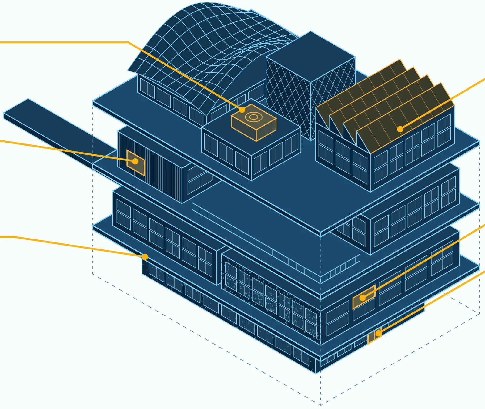
This illustration shows how components relate to product passports. It does not demonstrate live registry connections.
04 / USE CASES
Provide traceable as-built data for planning, tendering and cost estimation.
Support due diligence for sales, financing and insurance with structured building and material data.
Bring building, material and CO₂ data together as a foundation for ESG and regulatory reporting.
05 / GEOSCAN SPIN-OFF
GeoScan invites strategic investors to help shape the digital lifecycle of buildings.
Our planned spin-off brings experience in reality capture and BIM together with the development of a connected building and product passport ecosystem. We are looking for partners to advance technology, market access and long-term development together.
The investment structure, terms and timetable will be discussed individually.
Existing buildings, fragmented information and the need for a usable data foundation.
From scans and BIM models to product identity, evidence and lifecycle data.
Explore strategic investment, pilot applications and scaling in a personal conversation.
MEET US IN PERSON
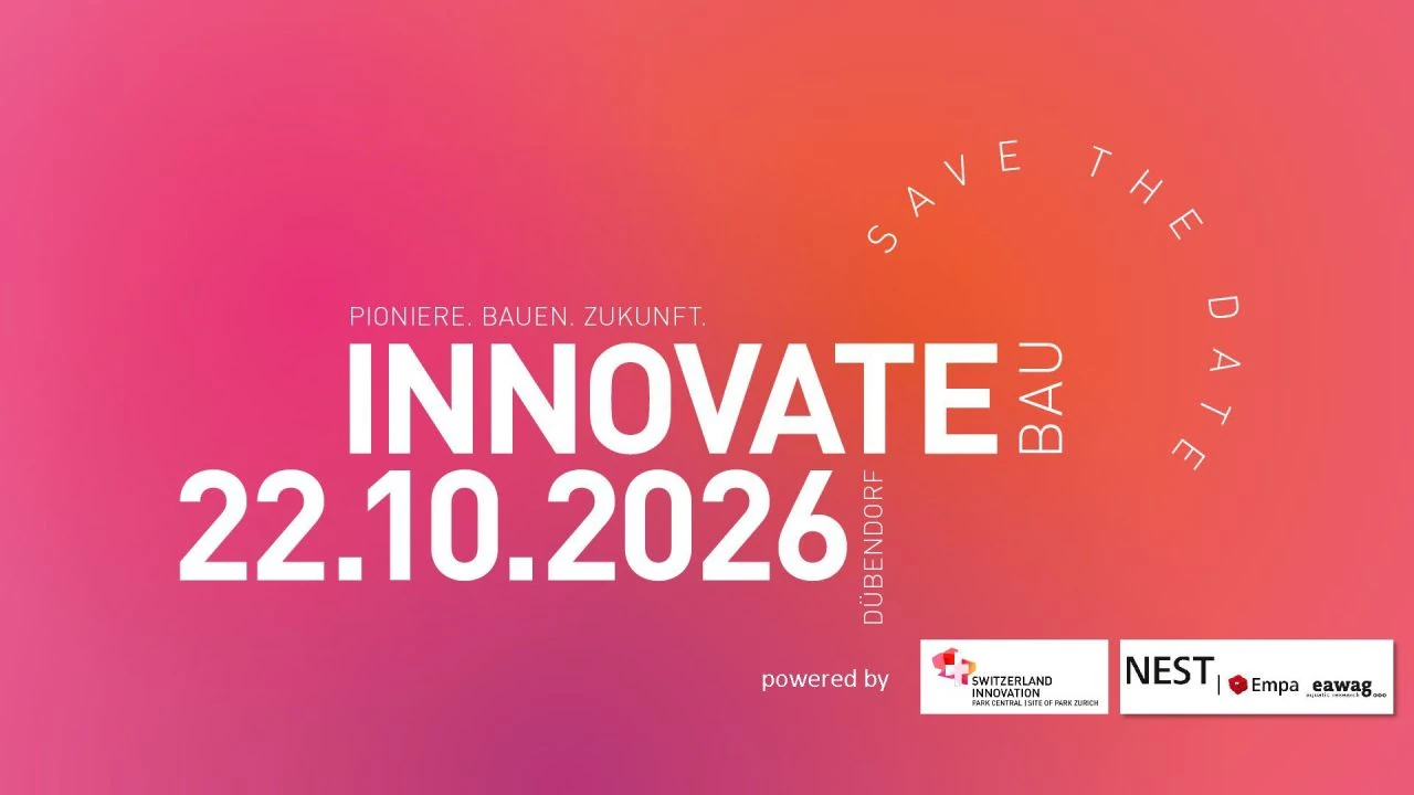
On 22 October, we will present GeoScan as a spin-off at INNOVATE Bau. Discover our vision and talk to us about investment, collaboration and the next steps.
GEOSCAN ON STAGE
16:00 · Europe/ZurichFor a personal meeting, we will agree a time and meeting point with you.
GOOD TO KNOW
A building passport brings together information about a building and its installed elements. A digital product passport describes a product and its associated data. GeoScan aims to connect these two levels in a traceable way.
We discuss your building, available documentation and how you intend to use the data. We then agree the survey, model scope, data formats and project schedule with you.
Start with a personal conversation or meet us at INNOVATE Bau. Together we can explore your strategic contribution, potential pilot projects and an investment opportunity. Financial terms have not yet been published.
06 / CONTACT
For property projects, partnerships or investment in our spin-off, contact us directly using the form.
Your contact
Klaus-Michael ChristensenCEO, GeoScan project
All enquiries to
info@geoscan.one
* Required fields